Rain-Soaked Canyons: Rockfalls Close Utah Roads
Prolonged weekend rainfall triggered debris in Parleys Canyon, forcing a partial closure of I-215 and raising safety questions for hikers and drivers.
By Enzo Conti ·
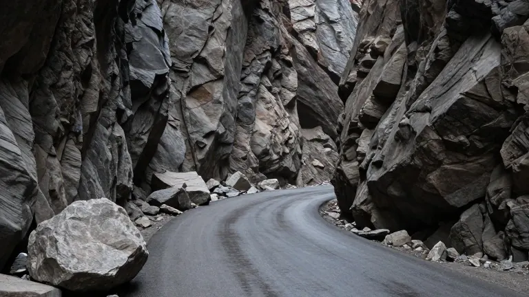
Rock debris forced a partial closure of Interstate 215 in Parleys Canyon on Sunday night. The incident occurred after a stretch of prolonged rain saturated the ground, a condition experts link directly to sudden geological shifts. This event is the latest in a series of rockfalls across the state that have intensified scrutiny of how weather interacts with steep terrain.
Provo Canyon and Zion National Park have also seen rockfalls in recent weeks. Greg McDonald, a senior hazards geologist with the Utah Geological Survey, stated that these events are likely driven by weather patterns rather than seismic activity. He noted that the specific event in Parleys Canyon was probably caused by the sustained rainfall over the weekend. While earthquakes can trigger such events, McDonald said the current pattern points to atmospheric conditions as the primary driver.
Geologists describe rockfalls as events that develop slowly but release suddenly. McDonald explained that the source material is typically weakened over years by freeze-thaw cycles and weathering. This conditioning phase happens underground or within the rock face before a specific trigger, such as heavy rain, causes the material to detach. The result is a rapid collapse that offers little to no warning to those below.
The Utah Geological Survey is currently creating hazard maps for the Wasatch Front. The agency aims to identify high-risk areas before new construction takes hold. McDonald said the team has already produced maps for the St. George area, a region experiencing rapid population growth. The goal is to allow developers and planners to account for these risks during the design phase, ensuring infrastructure can withstand potential geological events.
For residents and visitors, the danger lies in the lack of advance notice. McDonald said rockfalls often happen with zero warning, making the moment of collapse critical for survival. He described the event as a sudden, bad moment that can strike without prior indication. This unpredictability makes areas with high cliffs and loose boulders particularly hazardous for traffic and foot traffic.
Hikers and drivers are increasingly encountering these risks. Emilio Cantu, who was hiking in the area, said a rockslide had never crossed his mind before the recent events. The recent rainfall has made canyons visually striking but also physically active. The incidents serve as a practical reminder for anyone navigating cliff-lined roads or trails to remain aware of their immediate surroundings.
The Utah Geological Survey continues to monitor conditions across the state. The agency tracks rockfalls alongside landslides and debris flows. As development expands into steeper terrain, the survey’s mapping work provides the data needed to understand where the ground is most vulnerable. The data helps communities prepare for events that can happen with minimal notice.
Source: KSTU